





7 Shocking Reasons the Flood Watch Could Turn Dangerous Faster Than Expected
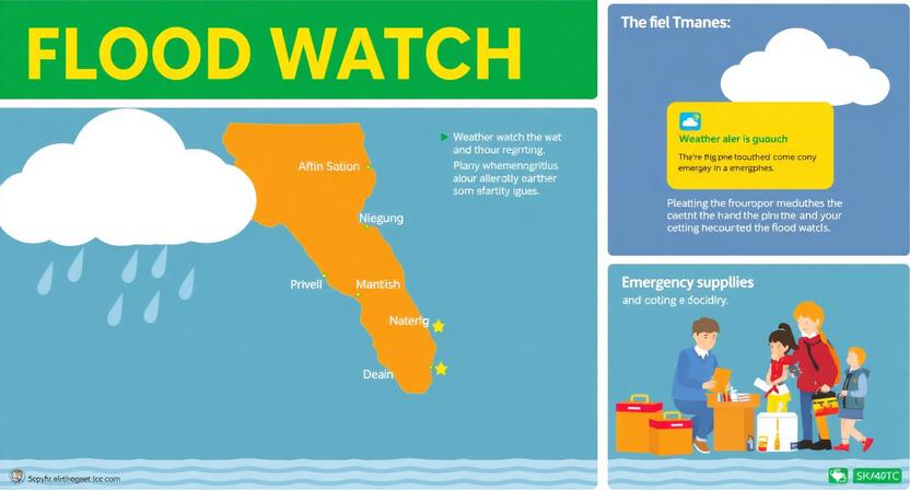
Table of Contents
Flood watch are among the deadliest weather-related disasters in the United States and continue to cause billions of dollars in damage every year. Recent deadly floods in Texas and severe weather outbreaks across multiple states have shown how quickly a seemingly routine weather alert can become a life-threatening emergency.
As severe weather events become more frequent, staying informed is more important than ever. For more breaking weather stories and trending news updates, visit our Latest News section at Global News Signal Latest News.
Understanding What a Flood Watch Really Means
A flood watch is issued when weather conditions are favorable for flooding to occur. It does not guarantee flooding, but it signals that people should prepare and closely monitor weather updates. The National Weather Service describes it as a period when flooding is possible because of developing weather conditions such as heavy rainfall, saturated ground, or rising rivers.
Many people misunderstand this alert because the word “watch” sounds less serious than “warning.” In reality, a flood watch can be the critical window that allows families to prepare, gather emergency supplies, and move to safer locations before conditions worsen. Waiting until a warning is issued may leave little or no time to react, especially in areas prone to flash flooding.
Flood Watch vs. Flood Warning
| Alert Type | Meaning | Recommended Action |
|---|---|---|
| Flood Watch | Conditions are favorable for flooding | Stay alert and prepare |
| Flood Warning | Flooding is occurring or imminent | Take immediate action |
| Flash Flood Warning | Dangerous flooding is happening or expected soon | Move to higher ground immediately |
Reason #1 – Heavy Rain Can Intensify Within Hours
Weather systems can change with remarkable speed. A storm that initially appears manageable may suddenly pull in additional moisture and produce intense rainfall. Meteorologists frequently observe storms that strengthen within just a few hours, transforming ordinary rainfall into dangerous flooding conditions.
Think of the atmosphere like a sponge. At first, it slowly absorbs moisture, but eventually it becomes saturated and releases water rapidly. That’s exactly what happens during many flood events. Communities that start the day with light showers can end up facing flooded roads and overflowing rivers by evening.
Recent National Weather Service flood watches have warned of rainfall rates reaching two inches per hour in some regions, enough to overwhelm drainage systems quickly.
Reason #2 – Flash Floods Develop Faster Than Most People Expect
Flash floods are among nature’s most terrifying events because they can develop within minutes. Unlike river floods that may take days to build, flash floods often strike with little warning.
The National Weather Service describes flash flooding as sudden and violent, capable of developing in just minutes to a few hours.
This speed is precisely what makes a flood watch dangerous. People often believe they have plenty of time to react because no flooding has occurred yet. Then conditions change rapidly, and roads become rivers before they can escape.
The tragic Texas floods demonstrated how devastating flash flooding can be, resulting in more than 130 fatalities and billions in damages.
Recent weather events in New York highlight how quickly conditions can deteriorate. A Flash Flood Warning was issued for parts of the Finger Lakes and Central New York due to severe thunderstorms, demonstrating why residents should never ignore a flood watch. Read the full report here: https://www.syracuse.com/weather-alerts/2026/07/flash-flood-warning-active-for-finger-lakes-central-ny-until-saturday-evening-due-to-thunderstorms.html.
Reason #3 – Urban Areas Flood More Quickly Than Rural Regions
Cities are surprisingly vulnerable during heavy rainfall events. Concrete, asphalt, and buildings prevent water from soaking into the ground naturally. Instead, rainwater rushes into storm drains that can quickly become overwhelmed.
Imagine pouring a bucket of water onto a sponge versus pouring it onto a sheet of glass. The sponge absorbs the water, but the glass sends it rushing across the surface. Urban environments behave much like that sheet of glass.
Major cities frequently experience flooded underpasses, submerged vehicles, and overwhelmed drainage systems during intense storms. Even a few inches of rain can cause significant disruptions when the water has nowhere to go.
Reason #4 – Saturated Ground Increases Flood Risk
Flooding often depends not only on how much rain falls today but also on how much rain has fallen recently.
When the ground is already saturated, additional rainfall has nowhere to go. Instead of soaking into the soil, water immediately begins running across the surface and collecting in low-lying areas.
The National Weather Service regularly highlights wet ground conditions as a major contributor to flood risks because they significantly increase runoff potential.
This is why a moderate rainstorm following several days of precipitation can sometimes cause more flooding than a single intense storm occurring after a dry period.
Reason #5 – Rivers and Streams Can Overflow Suddenly
Many people live near rivers, creeks, and streams without realizing how quickly water levels can rise.
Small streams can become raging torrents after prolonged rainfall upstream. The danger is particularly deceptive because residents may not even see heavy rain where they are located. Water can travel downstream rapidly and produce flooding many miles away from the original storm.
Flood watches frequently mention the possibility of excessive runoff affecting rivers and low-lying areas.
The calm creek near your neighborhood today could become a dangerous flood zone overnight.
Reason #6 – Nighttime Flooding Reduces Reaction Time
Flooding becomes significantly more dangerous after dark.
Visibility decreases, making it difficult to recognize flooded roads, rising water, and damaged infrastructure. Drivers may unknowingly enter dangerous areas because they cannot see the depth of standing water.
Nighttime also affects decision-making. Most people are asleep when severe weather strikes, reducing their reaction time and increasing confusion during emergencies.
Some of the deadliest flood events in recent years occurred overnight, catching communities by surprise and limiting opportunities for evacuation.
Reason #7 – Many People Wait Too Long to Act
Human psychology plays a major role in flood-related fatalities.
People often assume conditions won’t become serious or believe they have more time than they actually do. This false sense of security can delay evacuation decisions until escape routes are already flooded.
Emergency managers frequently emphasize that a flood watch is not merely informational. It is a signal to prepare. Communities located near rivers or flood-prone areas should use this time wisely by gathering emergency supplies, charging devices, and reviewing evacuation plans.
As one emergency saying goes: “Turn Around, Don’t Drown.” Entering floodwaters, even in vehicles, remains one of the leading causes of flood deaths.
How to Stay Safe During a Flood Watch
Preparation can dramatically reduce your risk during flooding events.
Essential Safety Steps
- Monitor local weather updates continuously.
- Charge phones and emergency devices.
- Prepare an evacuation kit.
- Avoid driving through flooded roads.
- Know your evacuation routes.
- Move valuables to higher locations.
- Stay away from rivers and drainage channels.
Emergency Supply Checklist
| Item | Why It’s Important |
|---|---|
| Water | Drinking and sanitation |
| Flashlight | Power outages |
| Batteries | Backup power |
| First-aid kit | Medical emergencies |
| Medications | Health needs |
| Portable charger | Communication |
| Important documents | Identification and insurance |
Flooding also has long-term health impacts. Research has shown increased hospitalizations and health complications following severe flood events, emphasizing the importance of preparedness and recovery planning.
Conclusion
A flood watch should never be treated as a minor inconvenience. It represents a period when weather conditions have aligned in a way that makes flooding possible, and history has repeatedly shown that conditions can deteriorate with alarming speed.
Heavy rainfall can intensify unexpectedly, flash floods can form within minutes, cities can become water traps, and rivers can overflow without warning. Nighttime flooding and delayed reactions only add to the danger.
The next time you see a flood watch issued for your area, think of it as an opportunity rather than an interruption. It is your chance to prepare, protect your family, and stay one step ahead of a potentially deadly situation.
Frequently Asked Questions
1. What does a flood watch mean?
A flood watch means conditions are favorable for flooding, but flooding has not necessarily begun.
2. How long does a flood watch usually last?
It can last several hours or even an entire day, depending on weather conditions.
3. Should I travel during a flood watch?
Travel should be limited, especially if heavy rain is expected or roads are prone to flooding.
4. What is the difference between a flood watch and a flash flood warning?
A flood watch means flooding is possible, while a flash flood warning means dangerous flooding is imminent or already occurring.
5. Why are flash floods so dangerous?
They develop rapidly, often within minutes, leaving very little time for people to react or evacuate.